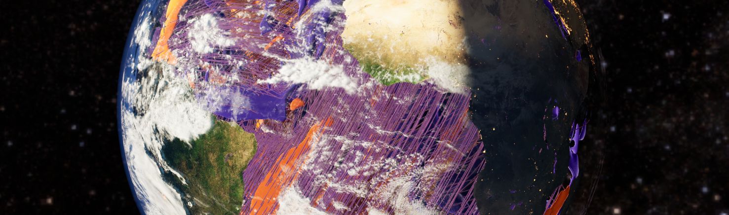
The day inside the Earth begins with a flight through space above Africa’s west coast. North of Morocco and west of Gibraltar, the view dives through the atmosphere and clouds into the Atlantic and further into the Earth’s interior: here, viscous masses rise from the hot core, cool down, and are pressed under high pressure against the underside of the mantle. In this way, billions of years ago, the first landmasses were lifted to the surface of the primordial ocean, forming plates that slid over or under each other, from which continents and islands broke away. “The video Within the Marble visualises data from geophysics,” explains Elisabeth Mayer, who processes simulation data into VR applications or short videos at the Centre for Virtual Reality and Visualisation (V2C) at the Leibniz Supercomputing Centre (LRZ). “An existing model of mantle convection was recalculated in higher resolution, now showing even more details of processes inside the Earth and from its history.”
The previous version focused on the formation of continents and is shown at the American Museum of Natural History in New York. The current geophysical simulation, calculated by a research group from Ludwig-Maximilians Universität, the Technical University of Munich (TUM), and Friedrich-Alexander Universität Erlangen-Nürnberg (FAU) as part of the CoMPS project, traces the immense processes inside the Earth even more precisely: it depicts, for example, the movements of glowing masses in orange, their cooling in purple, and uses lines to show how pressure, force and motion fields, as well as velocities, build up inside the globe – and how this in turn influences the Earth’s surface topography or seismic activity. Using graphic programs and game engines – originally designed for building computer games – a team led by researcher Emilio D’Ascoli, together with Mayer and her colleagues, produced a VR programme from the simulation data. This allows viewers to immerse themselves in the simulation and, by zooming in on details or regions, understand how particles move inside the Earth, how mountains and volcanoes form, and where earthquake risks accumulate. The video"Within the Marble" was also derived from this: “The challenge is to reduce content for visualisation without distorting it, so that we can view it seamlessly in virtual reality or as a video without background calculations,” Mayer explains. Any computation would cause short interruptions, making the display stutter and spoil the visual impression.
The actual mantle convection simulation comprises around 6.5 terabytes of information. Only a fraction is used for visualisations: the VR application is based on about 575 gigabytes, while the video uses 21 gigabytes of data processed with ParaView and Unreal Engine. “The simulation shows each development in 61 time steps, resulting in rather abrupt, angular movements,” says Mayer. Together with her colleague Thomas Odaker, she interpolated these image data with ParaView to 1,000 time steps: “This makes the movements look more natural and fluid.”
While the VR application focuses on displaying simulation data and allows zooming into detailed movements or processes inside the Earth, the video uses high-resolution NASA images for the rapid camera flight into the Earth and back out into dark space. This creates a narrative of a day inside the Earth—or the marble. “Compared to the model, the visualisation is tiny,” Mayer describes one challenge. “I had to ensure that curves didn’t bend too sharply or that the camera moved along an imagined straight line. Any twitch would cause major visual shifts.” Achieving this requires patience and persistence, but above all a steady hand when using the mouse. The simulation describes the Earth at a resolution of about 10 kilometres, which in the video corresponds to milli- or even micrometres.
The video also contains no cuts – the journey into the globe, through the masses and back out is staged as a continuous day trip. “By switching views, you can cleverly combine different perspectives and hide minor errors when cutting back and forth,” says Mayer. “That’s not possible in a one-take.” The angle of sunlight and the abstract representations of pressure and velocity – shown in the video by lines of varying thickness and colour—must also be correct. The advantage of this recording technique: the video can be played in an endless loop if needed.
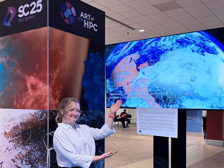
The VR view into the Earth’s interior was presented in May in Hamburg at the Supercomputing Conference ISC-HPC25, while the short video was recently shown at the “Art of HPC” exhibition during SC25 in St. Louis. “This year, a continuous exhibition was prominently set up in the entrance area, and several monitors drew attention to the presentations,” Mayer reports. “The response to the video was positive; many asked me about its creation and the techniques used.” The video conveys the fundamentals of geophysics and inspires interest in Earth’s history. The CoMPS research team plans to use the video in presentations related to the simulation, and it will be on display at the LRZ’s Centre for Virtual Reality and Visualisation. Meanwhile, Elisabeth Mayer is already thinking about what she could illustrate next year: “I’d love to work on a topic from medicine.” (vs | LRZ )
CoMPS stands for Multi-Physical Simulations for Geodynamics on Heterogeneous Exascale Systems. This project extends existing scientific codes such as Terra or Hybrid Tetrahedral Grids (HyTeG) – which describe mantle convection inside the Earth – by adding parameters such as force and motion fields and increasing resolution significantly. Alongside the LRZ, which provides the technical infrastructure, the Chair of System Simulation at FAU and the Chair of Numerical Mathematics at TUM were involved. Within this framework, and effectively as a use case, processes inside the Earth were simulated and visualised at the LRZ. One outcome of CoMPS is the TerraNEO code, which is now running on the high-performance systems of the Gauss Centre for Supercomputing (GCS) and continues to be optimised.